Late last year, Safariland’s Editor reached out to me and asked me if I would attend fellow Safariland blogger and personal friend Kevin Estela’s land navigation course in New York. My immediate thought was, I get to spend time with my friend Kevin, train, and write an article promoting what a great instructor Kevin is? How could I say no?
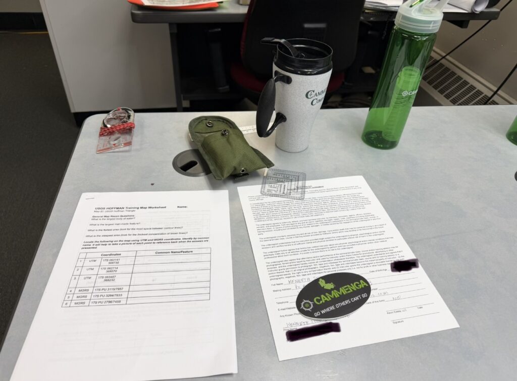
The class was well thought out. Everything you needed was provided: Maps, a compass, and a protractor. All you needed was yourself (and wet weather gear – it did rain a little).
Kevin’s approach to training is just like what you would expect from any experienced and talented instructor, who is both knowledgeable and passionate about their discipline — crawl, walk, run. I have found that this type of “building block” approach is best. Anyone who has trained in Brazilian jiu-jitsu and been told to “trust the process,” left frustrated, and then gone on to a school that truly teaches beginner classes will know exactly what I mean.
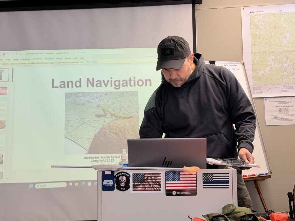
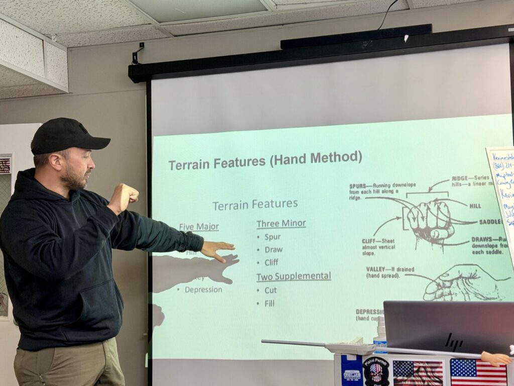
The class started in the classroom with introductions and paperwork. With that out of the way, Kevin dove right into the material. He covered some basic land navigation concepts and the differences between military and civilian land navigation.
Kevin mentioned how some of his prior students touted their success in the land navigation portion of US Army Special Forces Selection and Assessment (SFAS), citing the concepts and practical exercises they learned from Kevin. Being in the Fort Bragg area and with connections to that world, training with Kevin in the Fort Bragg area would be a smart move for anyone training up for SFAS.
Key tasks like how to obtain up to a 10-digit grid coordinate, how to identify terrain features, how to shoot an azimuth with a compass, using a protractor, measuring distance on a map, grid and magnetic north, and more were all covered.
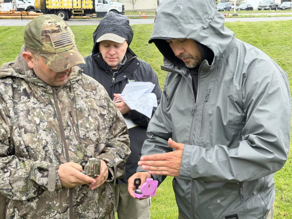
After the initial classroom portion, Kevin took us outside to learn our “pace count.” He used a much different method than I had learned in the military, but it works! What I liked about Kevin’s method is that you can estimate your time to travel a certain distance. While we might have, I don’t remember learning to estimate the time it would take to travel a given distance in my military land navigation training. If you are a guide, a hiker, or a hunter, this could come in handy to help get you or your group out of the woods before dark.
From there, we did several practical exercises, shooting azimuths and using our pace count. Prizes were given out to those closest to Kevin’s pre-checked distance and direction measurements on the final outdoor exercise.
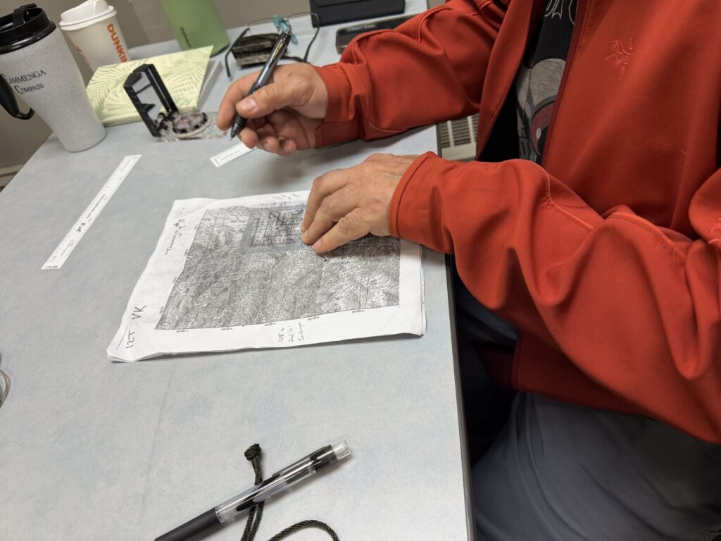
After the field exercises, we were back inside to discuss slightly more advanced techniques like finding your exact position on a map using resection and triangulation if you are not sure of your location, planning routes back to a start point with deliberate offset, and navigation around terrain features, such as “boxing an obstacle” or avoiding others during route selection.
Throughout the course, Kevin always referenced how you can use this training for your own survival. That could be relaying your exact location to rescuers if you are lost or injured. This happens more often than you would think. When I worked for the New York State Park Police, we would routinely get calls for lost or seriously injured hikers.
We wrapped up by opening it up for any questions. Kevin offered to stay as late as possible for anyone wanting either more one-on-one training or more time to walk the course we did earlier for more reps.
This class was a one-day “Level One” and a great introduction to land navigation. Kevin also offers a Level Two and Level Three, which build on what you learned in Level One.
Whether you are training up for SFAS or you are a hiker, hunter, guide, or just want to be better skilled at the outdoors, Kevin’s land navigation classes are highly recommended. Kevin also has bushcraft and firearms training classes available at locations around the country.